Research
Research Interests
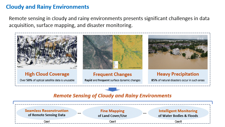
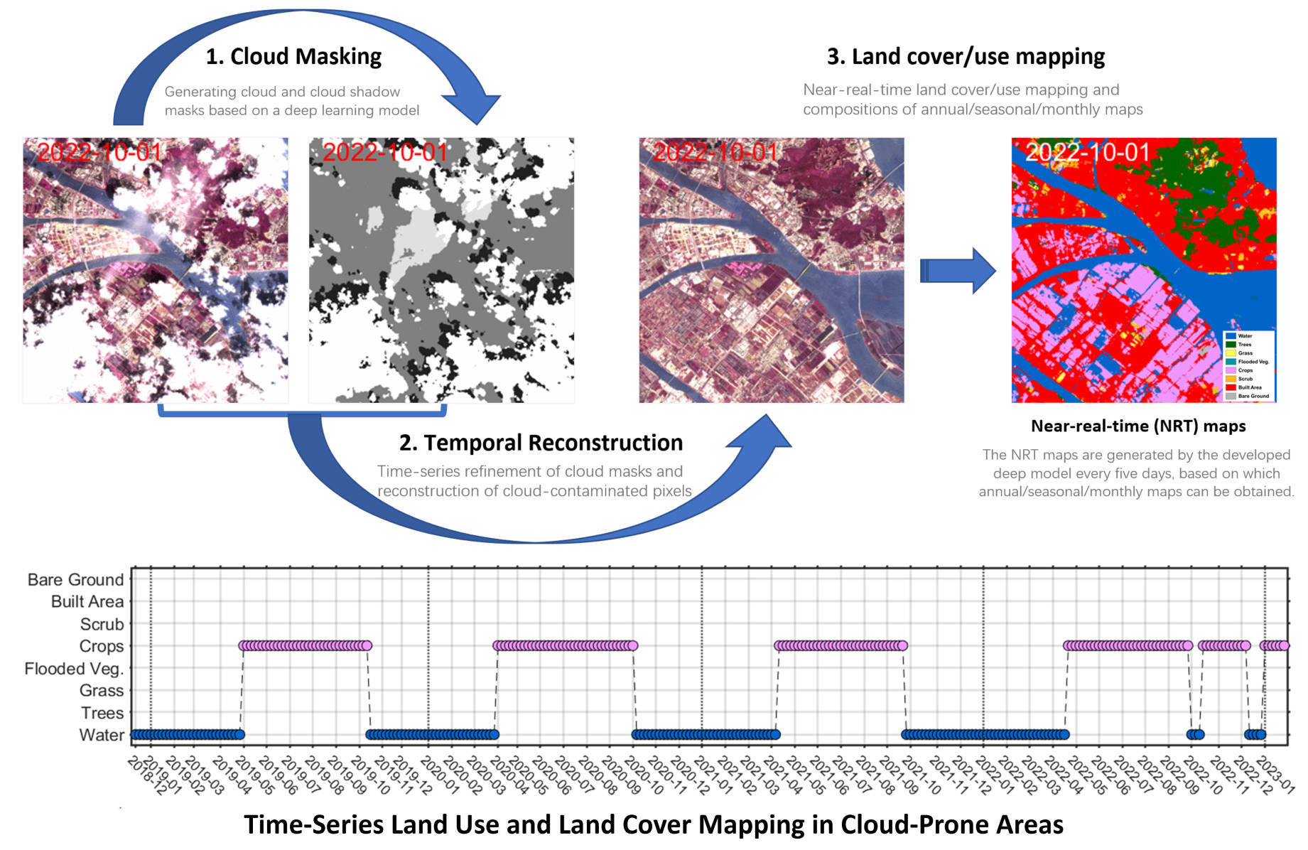
My research focuses on Remote Sensing of Cloudy and Rainy Environments, leveraging big Earth observation data and geospatial artificial intelligence (GeoAI) to address environmental and climate change challenges, particularly in tropical and subtropical regions prone to frequent cloud cover and heavy rainfall. This research aims to overcome cloud cover limitations in satellite imagery, enabling more reliable applications while advancing innovative solutions for environmental monitoring, disaster management, and sustainable development. My specific research interests include:
-
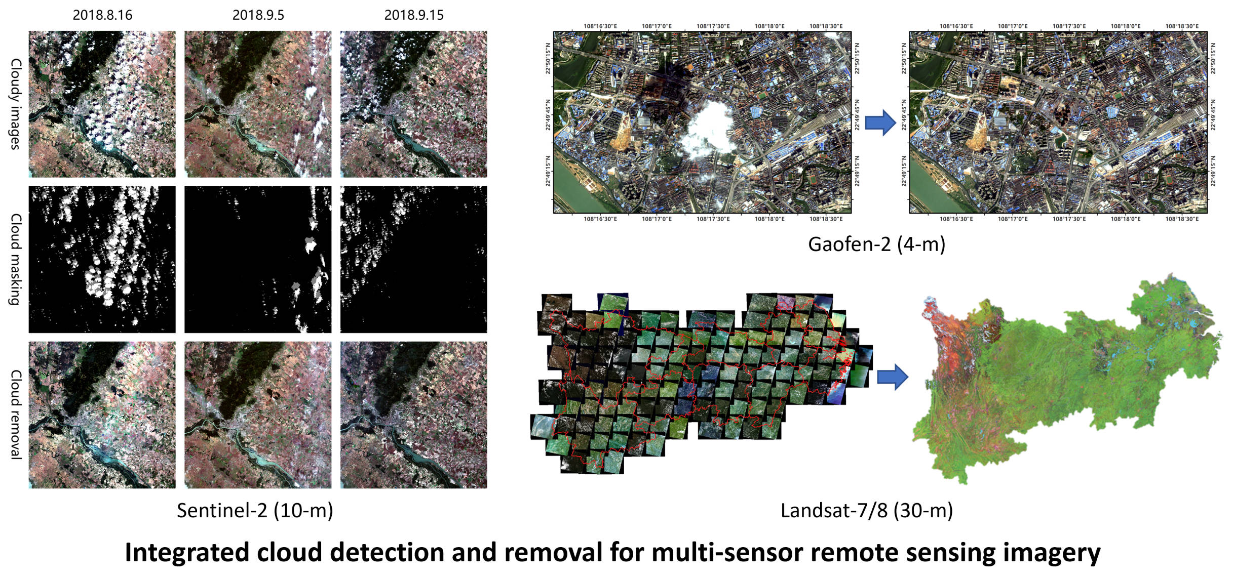
Cloud Detection (2017; 2019; 2022) and Removal (2019; 2021; 2024)
-
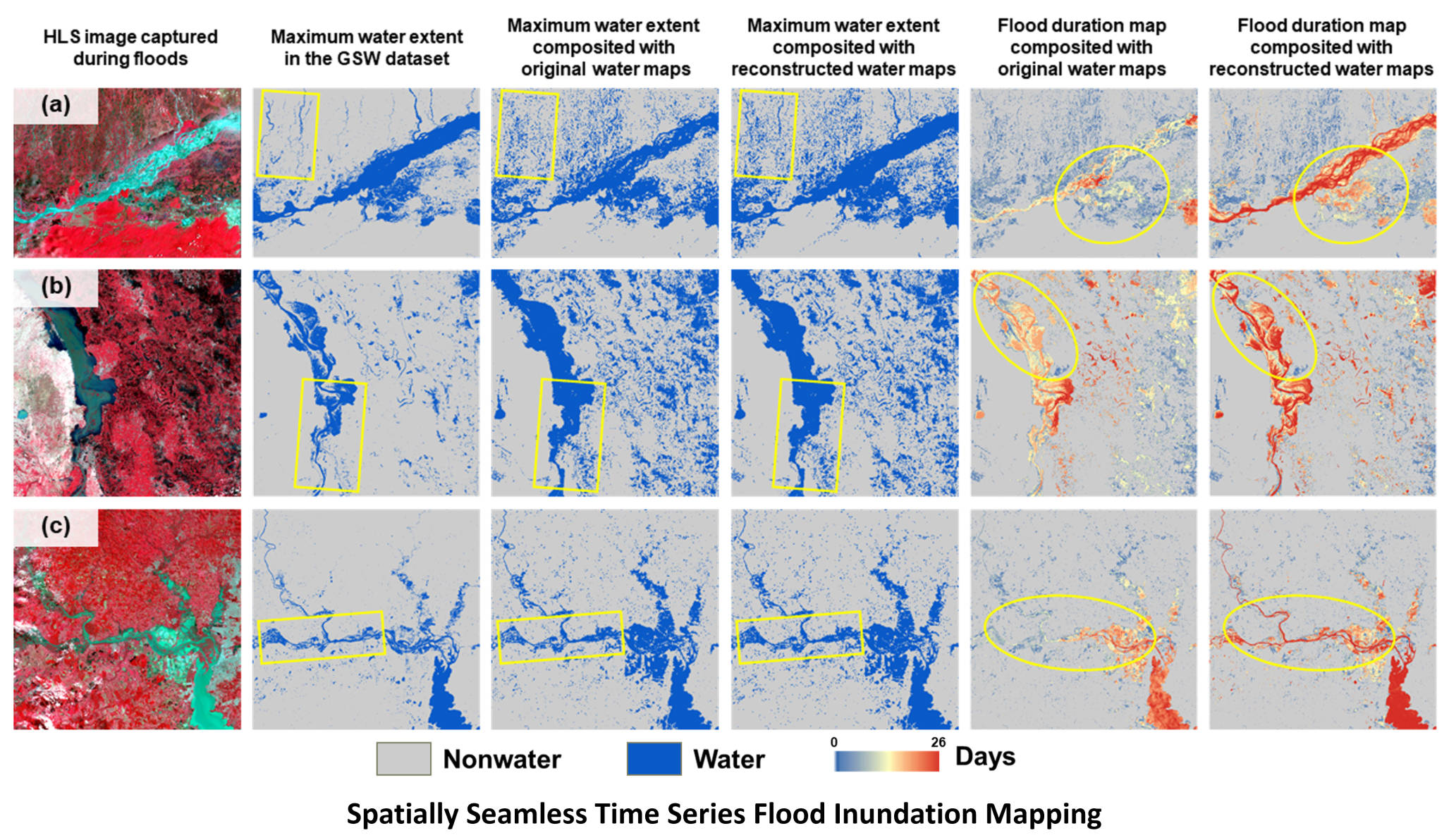
Flood Monitoring and Resilience Assessment (2024; 2024; 2025)
Selected Grants
-
Project Manager: AI-Driven, GIS-Compatible Vehicle Type Detection System Riding on Fusion of Satellite, CCTV, and Geospatial Data, Hong Kong Smart Traffic Fund, HKD 3,230,831, 2025-2027.
-
Co-PI: A Pilot Study of Geospatial AI and Big Data for Smart City Applications: Foundation Model and Specific Methodologies, The Hong Kong Polytechnic University, HKD 820,000, 03/2025-02/2027.
-
PI: Near-Real-Time Flood Monitoring in Cloud-Prone Areas Incorporating Multi-Sensor Satellite Imagery, The Hong Kong Polytechnic University, HKD 730,800, 02/2024-01/2026. (Terminated)
-
PI: Intelligent Reconstruction and Fusion of Multisource Remote Sensing Data for High-resolution Dynamic Land Use Mapping, The Hong Kong Polytechnic University, HKD 250,000, 09/2022-04/2025.
-
PI: Thick Cloud Processing Methods for Time-series Remote Sensing Images in Tensor Space, National Natural Science Foundation of China (NSFC), CNY 300,000, 01/2022-12/2024.
,,